I’ve spent a long time trying to work out exactly what I can see from where I live. I’ve used Google Earth to trace lines from my flat to prominent parts of the distant high ground.

By looking for landmarks along these lines – a prominent chimney, for example – and cross-checking with Ordnance Survey maps, I’ve been able to find the name of the bit of the horizon it is I’ve been staring at.
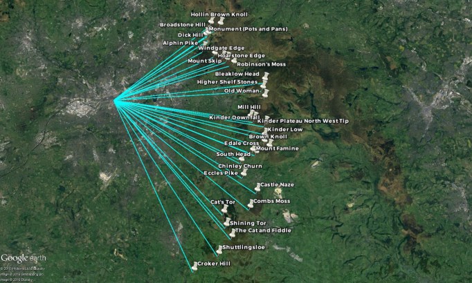
I can make sure something does indeed count as the horizon from this perspective by checking the elevation profile of the line.

And then I can pretty much confidently relate it all to what I see from home.
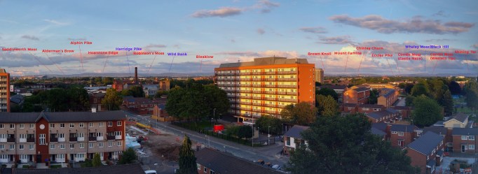
There’s only a certain section of the horizon that I can see from here. The higher buildings of Manchester city centre obscure my view of pretty much everything north and west of Saddleworth Moor.
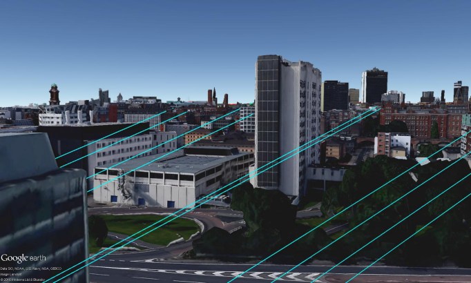
But I can switch off the buildings and see what I would be seeing.

So I can fill in the gaps and put a name to everything I’d be able to see from here, if I had an unhindered view.

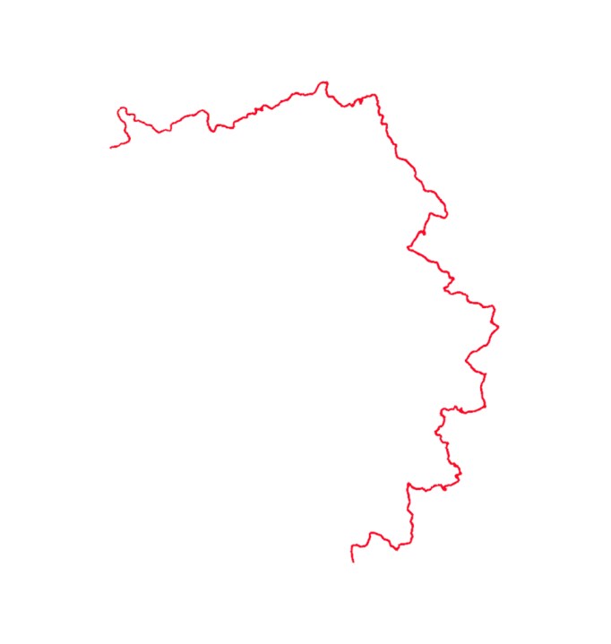
Cross-checking between Google Earth and Ordnance Survey maps, linking footpaths and existing trails official and unofficial (such as the great work done on the West Pennine Way by the Greenmount Village Community) I was able to put together a route which took it all in.

It’s 100 miles long. No part of the route is ever more than 20 miles from my home and a great part of it traces the line of the horizon as seen from my flat.
If you want to look at the route in more detail you’re very welcome to: here’s GPX and KMZ versions. If you were actually considering doing the walk by following this route, then I’d urge you to get in touch first – some parts were a bit less ‘horizon-y’ than I’d expected and could be improved. Also, a couple of small sections didn’t really offer a great reward for the effort and would benefit from some alteration. Mostly though, the walk was spectacular.
