Day 7 – Wayoh Reservoir to Winter Hill.

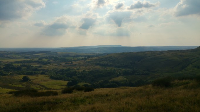
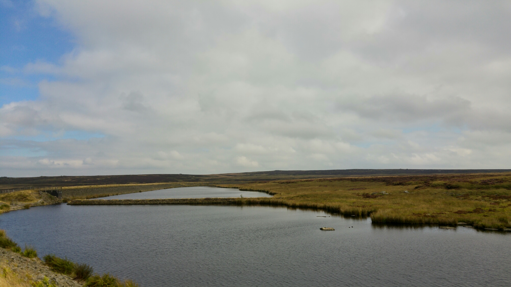
Wayoh Reservoir, Turton Heights, Longworth Moor, Belmont, Winter Hill. 8 Miles.

I have a problem with the word ‘challenge’ – specifically its seemingly increasing use as a noun. This whole horizon walk thing has certainly had aspects to it that are challenging and there have been plenty of times where I’ve felt challenged – but this isn’t ‘a challenge’.  Challenge fits too neatly into the neoliberal – ‘give it 110%’ shakedown we’re living grit-toothed through. Challenge is an aspect of what this is but only an aspect – there’s adventure, risk, uncertainty, fun, problem solving, physical effort, mental struggle and beauty – lots and lots of beauty. To privilege or emphasise challenge above these other facets of an outdoorsy undertaking seems unhealthily masochistic, and it’s bringing an instrumental, economic mentality into what should be a time/place for play. I’m quite happy to think of this walk as ‘playing out’.

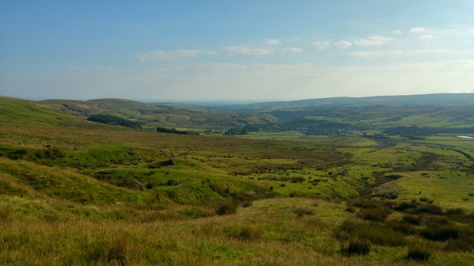
As for a purpose – there doesn’t have to be one beyond the playing with the landscape that drawing a line around it and then walking that line is. I have realised though that this walk does do something that seems kind of purpose-like: it makes my relationship with the horizon physical. I’ve grown up, worked and done pretty much everything I’ve done under the gaze of this crescent of hills – in a way they define me. I’m sort of paying tribute to that by walking it – I’m adding a physical element to the looking at and looking back.

IMG_20160819_071533.jpg

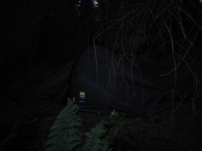
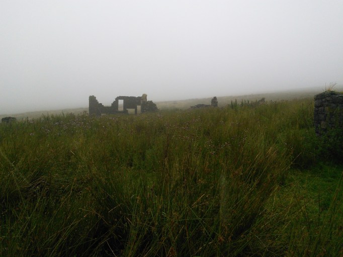
I wearily pack up the tent and head down from the woods to the reservoir. It’s a really beautiful place, but I’m eager to get away. I squeeze past a skip that’s been plonked at the start of a public footpath and then misnavigate into some farm buildings where, unnervingly, there’s what appears to be a fiercely torn open lorry trailer.

IMG_20160819_065448.jpg

IMG_20160819_065824.jpg

I find the right path eventually, and move through some grotty woods to a lane running between fields. It takes me past another old agricultural building re-purposed for the wealth-creators. As I pass I hear the security intercom sounding and think I must be being addressed – warned off perhaps – but then I realise that, bizarrely, the intercom is loudly playing a phone-in radio show.

I pass through a lovely little hamlet – stone houses jumbled around a curling cobbled lane – that feels occupied, as in taken over. The cars parked, the signs of renovation… I’m not imagining that these buildings were the scene of something idyllic, that was then crushed by a shockwave of cash from the cities, but there is a feeling of spoils being taken.

The Ordnance Survey map (digital) I’m using shows a public footpath running up through the drive of a farm, but as I get to it there’s a very unfriendly sign insisting that there’s no access this way and a CCTV camera on a tall metal stalk reinforces the point. I see there’s another way to the path further up the road and head up there seething a little. I think of paths as kind of sacred and there’s nothing that gives me more of a hit of civic pride than a well maintained and signposted public footpath. Maybe there was agreement about this one and the OS just hasn’t quite caught up; maybe there was some ceremony of deconsecration – maybe it isn’t just contempt.

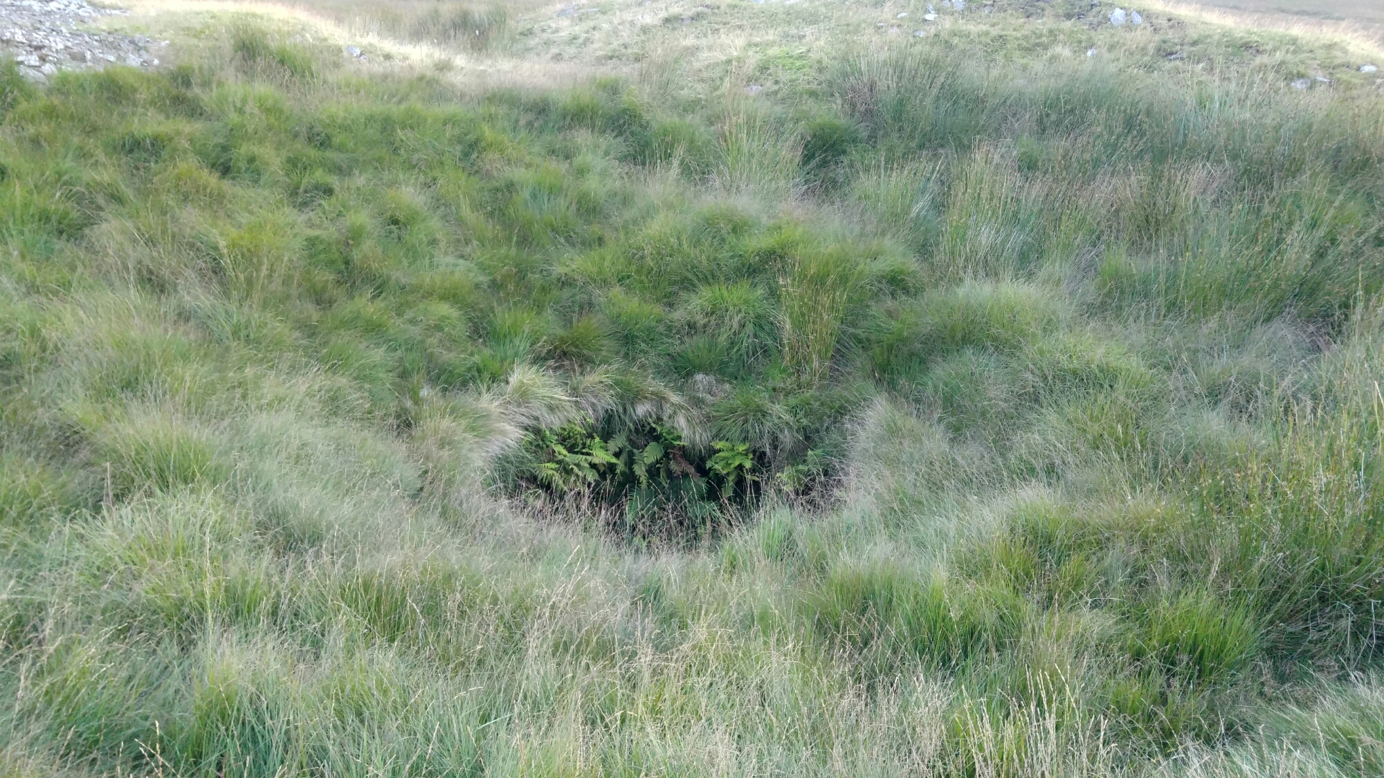
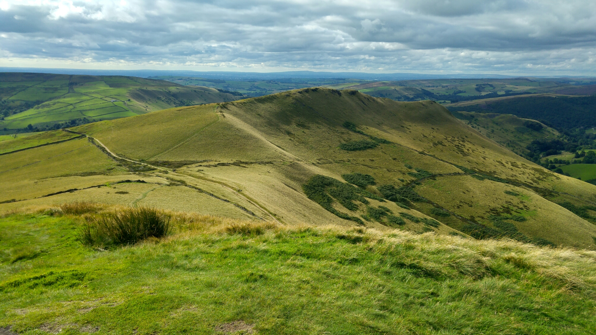
I find my way around to where I would’ve got to a bunch quicker and begin the trudge up to Turton Heights. It’s been threatening to rain all morning and now it starts – and it’s really going for it. I’m making my way up a signposted route through a field, but if the signs ever followed anything like a discernible path then it’s long overgrown. There are shoulder high rushes in enormous clumps and they quickly saturate my clothes as I squeeze through and stumble over them. I get to the top of the moor and it’s just chucking it down. I’m soaked and my shoes are audibly squelching as I walk. I realise how lucky I’ve been with the weather – I don’t know what I’d have done if there’d been two consecutive days like this earlier in the week. I don’t think I would’ve been able to handle it.

IMG_20160819_090625.jpg

I’m starting to shiver and I decide for the first time to cut out something on my route – I’ll skip Turton Moor and the Hanging Stones. I’ll come and look at them another time. Right now, for the first time in the whole adventure, I’m really not enjoying myself. It cuts two miles off my total, but I’m still happy I’ll have done my 100 miles – the detours from the main route to the campsites and such will have more than made up for the loss. It’s still a hard decision though and I hesitate on it for a good few minutes – but cold and weariness eventually win out, and I cut off the route and head towards Belmont.

IMG_20160819_105056.jpg

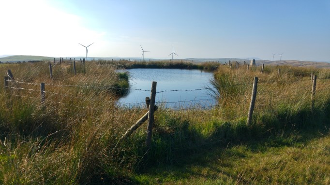
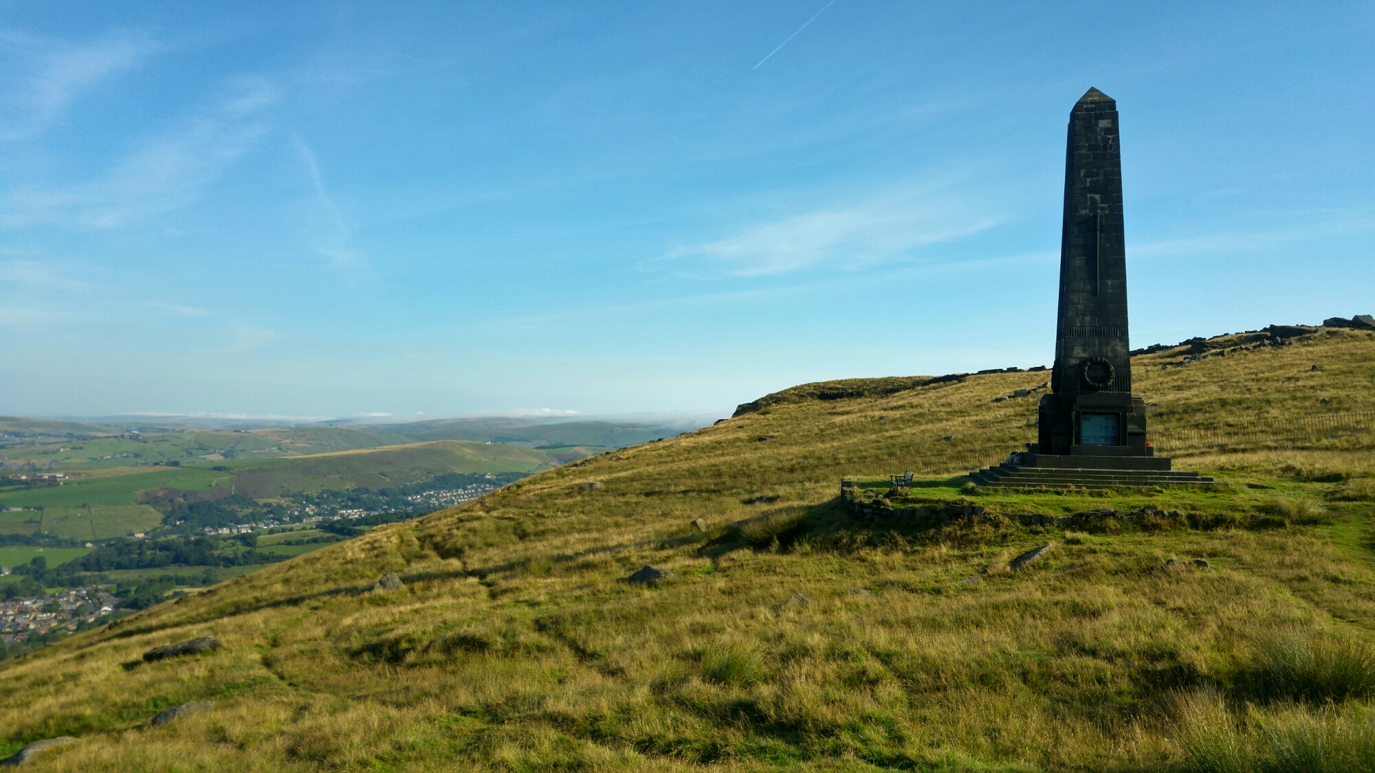
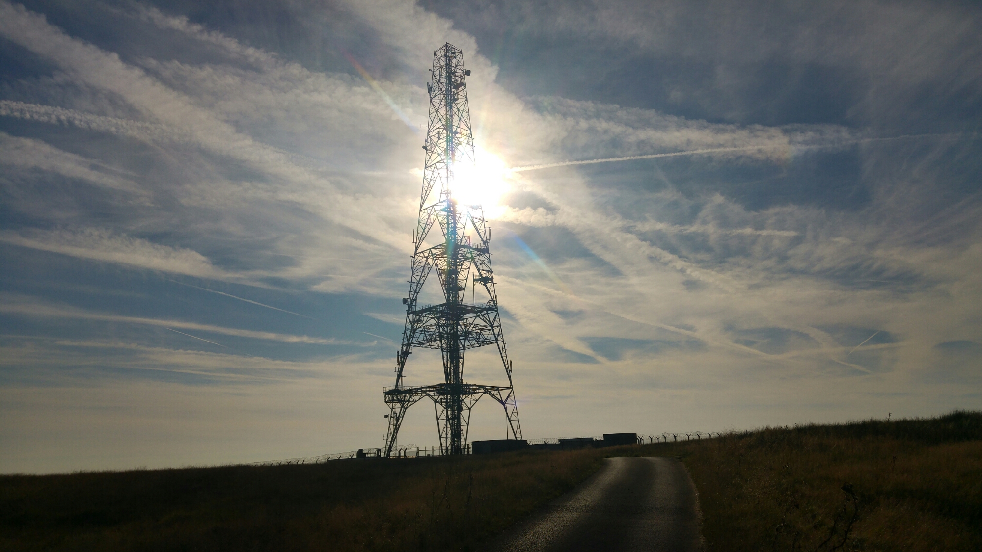
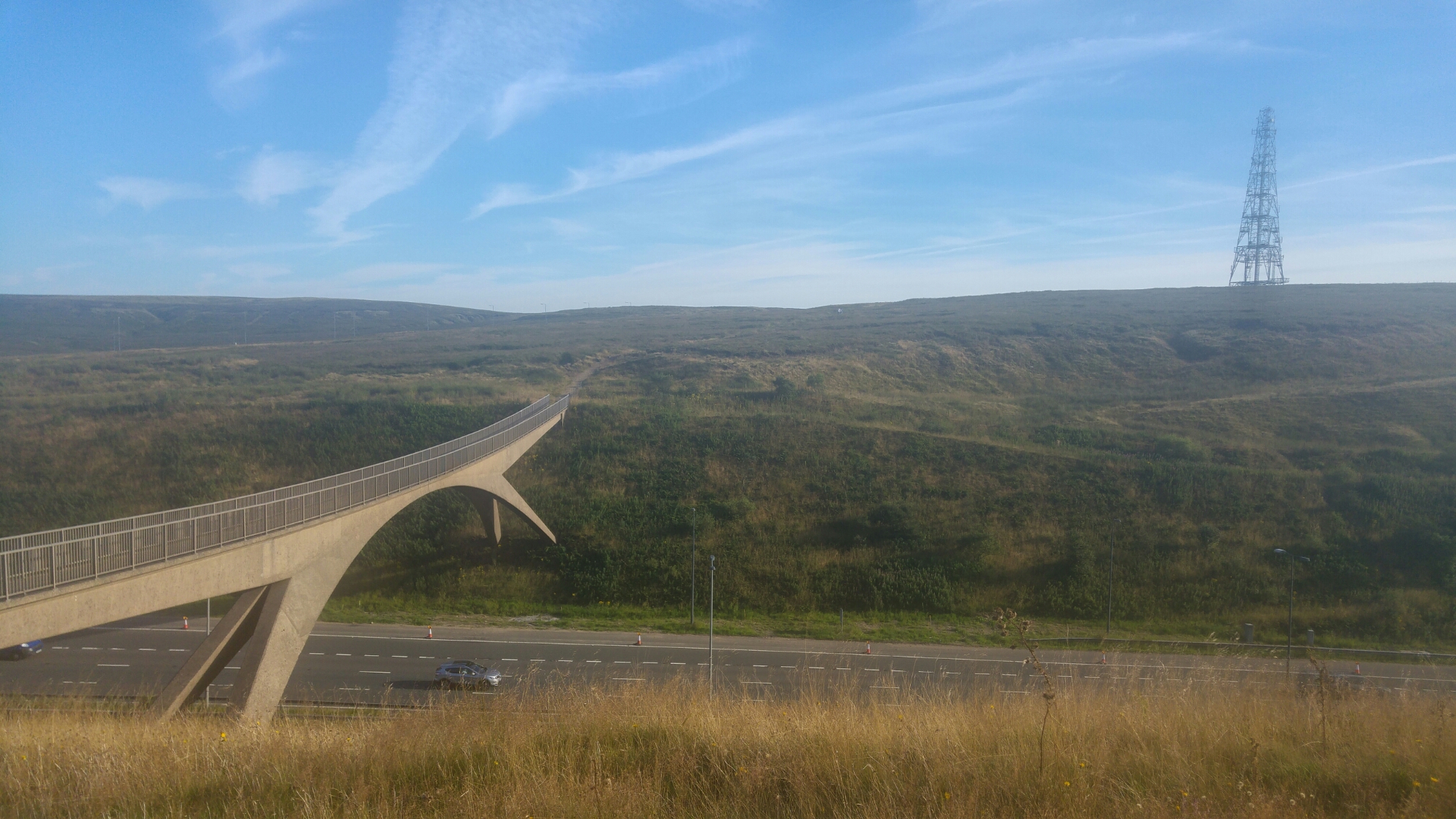
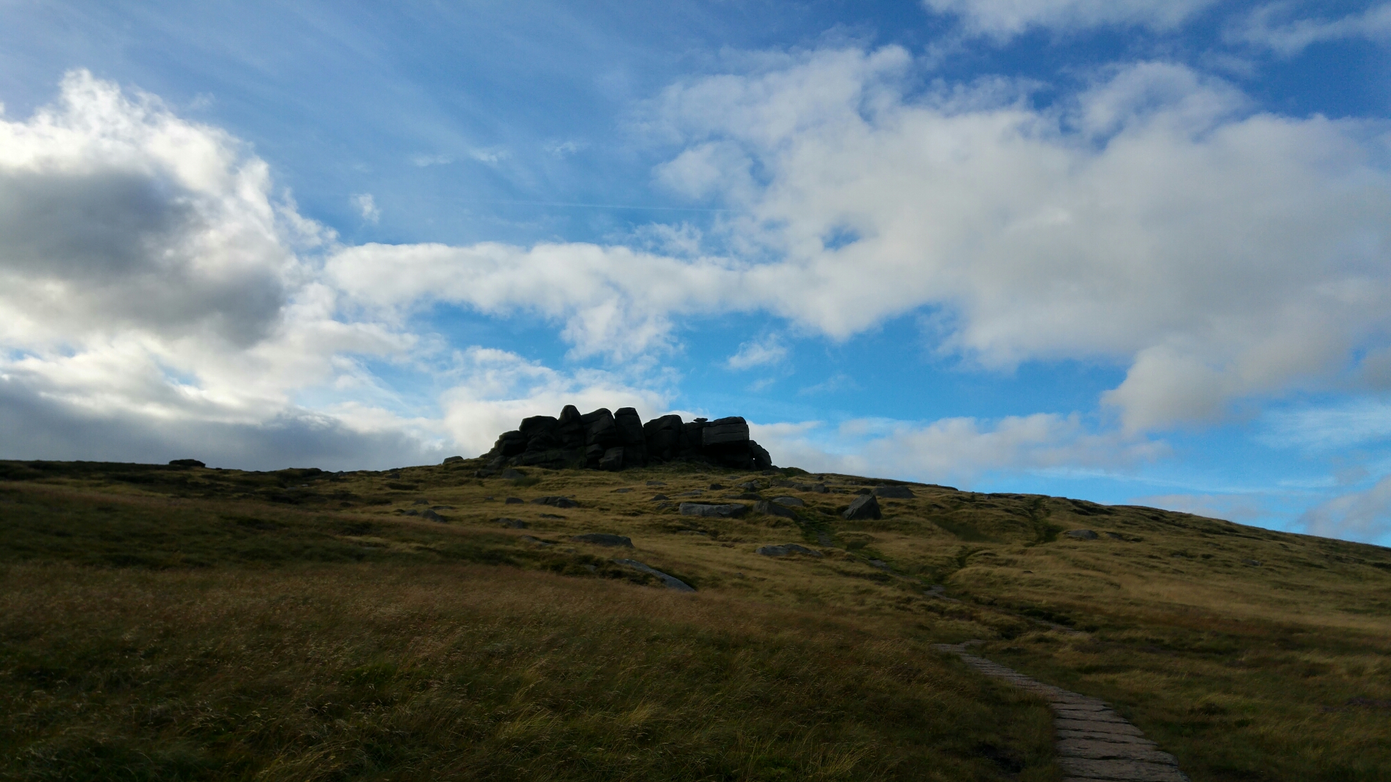
I’m at the foot of Winter Hill now, but I’m not ready to head up just yet – I need to get out of the rain if just for a few minutes. I head into the first pub I see  – the Belmont Bull -which, marvellously, has a sign saying ‘Muddy boots and wet bums welcome’ – I had been worried about exactly those things. I’m welcomed in by the barman, Tom. There’s no better icebreaker than looking like a defeated, sodden and overladen mess and we’re quickly talking about the walk I’ve been doing and how it’s all going to climax with Winter Hill. I complain to Tom about the rain and the rushes and he says something like – ‘Ah, the rushes, yeah. I do like a walk in the rain though’. Instantly I start to feel that I might have been being a bit soft about the rushy terrain of the West Pennine Moors. Tom says he knows a better way up Winter Hill than the one I’d been planning and I’m really happy to hear about it. It doesn’t appear on the OS maps and I never spotted it on Google Earth – but it sounds like it’s going to get me up there in a satisfyingly direct way. I try pouring the water out of my shoes, wringing out my socks and then giving them repeated blowings under the hand-dryer in the gents, but it’s really not making much of a difference. I have a couple of coffees and realise I’m starving so I order lunch. As I’m eating I have a wonderful realisation: I can leave the rucksack here. I’m going to be coming back here anyway – I’ve spoken to Rachel and she’s going to pick me up from here; I’m certainly not getting any Manchester horizon pics from the zoom-camera today; there’s nothing in there I’ll need up on the hill. I ask Tom if that would be cool and he says yes. This is amazing. I recheck the route with Tom and then set off – 33 pounds lighter. I’m practically skipping as I make my way to the outskirts of the village, past a little reservoir known locally as ‘The Blue Lagoon’, across some low wooden bridges over swollen streams and begin the ascent. The path is muddy, crumbly, full of slippy unstable rocks and great patches of bog and largely very steep – but it’s visible. It takes just under an hour for me to get up the first ascent, across the boggy ‘flats’ and then up onto the hill itself. Lord knows how long it would’ve been if I’d still had the weight of the rucksack on me. It’s really wild with wind and rain and the visibility is next to nothing. I can make out the smaller transmitters but not the main spire I’ve taken to be the end of my route. I find the trig point, which is great to see, but I want to find the fucking massive transmitter tower that’s on this hill but which is completely invisible to me now.

20160819_152716_HDR.jpg

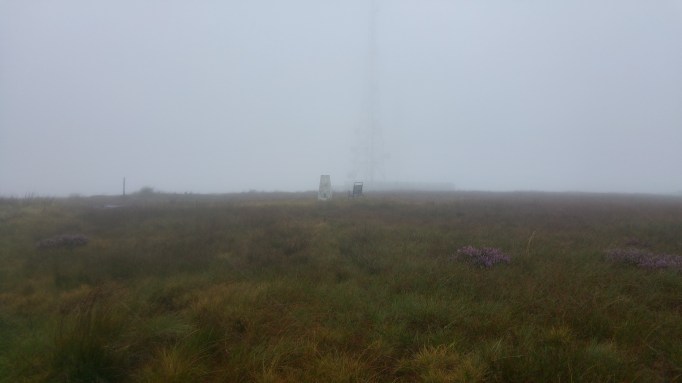
I get out my tablet with my OS map on it, hoping it will hold out in the rain for long enough to show me where to go, and I see that I need to follow a path southeast which then branches southwest and I’ll be there. Splashing directly through massive puddles – why bother going around when you’re already soaked? – I finally make it to the gates of the transmitter’s compound and… I still can’t really see it – there’s a sort of detectable darkening vertical line through the fog. That’s it. I try and do a quick video of myself being there and hurry off downhill.


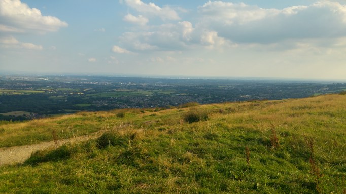
Seeing Manchester from this iconic bit of my horizon, and seeing the whole route that I’d walked to get here – the triumphant last gaze at it all – wasn’t going to happen. Sod it. It’s cold, let’s go. I scurry back down the path, which is by now pretty much a stream, cackling loudly and frequently.


Day 6 -Jackson’s Moor to Wayoh Reservoir.

Top o’ Leach, Hailstorm Hill, Tottington Higher End Moor, Whittle Hill, Peel Monument, Bull Hill, Wayoh Reservoir. 13 miles.

28983852242_d026beed2c_o.jpg

Pretty much constantly as I walk there’s a tune playing in my head. Often it’s a well-known song that’s just beamed in there – I’ve had Ramones, Al Green, Marvin Gaye, Shirley Bassey, ‘and many more‘ all cycling about this week. Sometimes it’ll be a more beloved thing from my past listening like a Hüsker Dü song or a bit of Mission of Burma or Amon Düül II. Then there’s the bastardised versions of popular songs: one such inexplicably constant companion is the first line of the Chris Rea song ‘Driving Home for Christmas’, but with the lyrics changed to: ‘Hydrochloric Acid… Is my favourite fuckin’ acid‘. Then there’s a whole bunch of things that I’ve just unwillingly made up – there’s about a whole musical’s worth of chorus-line, good-time, upbeat showtunes going on that are just INANE. Lastly, there’s the ones that relate to my current situation. So the other day when I was taking my first steps up Mount Famine having just added the contents of Stash 1 to my rucksack, feeling the extra weight, I had ‘Na, na, na, na, na, na, na, na, na, na, na, Baby give it up, Give it up BABY GIVE IT UP‘ looping loudly. This morning, awfully, but pertinently, I had Phil Collins’ ‘One more night… One more night‘ chiming on and on.

But despite that it was a great feeling having just one… further night before completing this adventure.

I could hear that work had begun at the quarry as I was setting off up the moor. The high-tufted grass was full of little dewy spider webs.

28471239133_4420fb70fb_o.jpg

29073241146_3cb009a3cb_o.jpg

After a bit of a disheartening early navigational struggle I found the path to Top O’ Leach and made it to its gorgeous summit. Wonderful views towards Rossendale, down into Calderdale and over Rochdale’s other tops, plus some ruins and TWO trig points. One of them seemed older, an earlier format.

29028773281_faa57be3be_o.jpg

29028939131_a1a7f73a11_o (1).jpg

I strode on to the nearby top of Hail Storm Hill and then went up the gently rising moor to Tottington Higher End Moor. I was in one of the biggest windfarms in the UK and I was having a ball being amongst these machines. I dislike the reindustrialisation of the hills – the roads for the maintenance vehicles, the large rubblefields and the slicing-through of old paths; and I’m full of disdain and suspicion of their makers – the Peel Group: the massive organisation that will probably build the next planet after it’s crushed all of Earth’s local councils with unrefusable leverage. But I really adore these things. They’re modern in an almost nostalgic sense… something about them reminds me of early ’80s kids’ sci-fi imagery. And the size of them, the sound of them and the giant swoop of the blades – despite all the reservations about why they’re here what they do and who benefits, I still find something marvellous and hopeful about them.


29028770171_d9bf3c0732_o.jpg

I descend into a deep clough and then drag myself up to the top of Whittle Hill. There’s a large cross sprouting from a cairn at the top. I joke in my head about it being a ‘response’ to the windmills – but then read the plaque at the top and discover it was a tribute to yet another victim of a plane crash – another one who came down on the hills. Apparently before a certain point people weren’t aware that wind speeds varied with altitude, and so pilots navigating in poor conditions would often calculate that they’d cleared higher ground and descend fatally early.

29012426451_3197f7c943_o.jpg

A long stroll down from the hills takes me into Ramsbottom, where I’ve scheduled a stop for an hour or two to recharge my phone so I can make sure I can let Rachel know when and where to pick me up from tomorrow. In the sunny high-street I’m conscious again of looking a bit untoward. I’m also noticing that people smell really nice. It’s reminding me of Mr Hanky from South Park – ‘You smell an awful lot like flowers‘ – which makes me worry about what scents I’m exuding. I hesitate on the threshold of Lola’s Vegan Restaurant, but I’m welcomed in and shown to a seat with a plug socket and given a glass of water unprompted because I ‘look thirsty’. I spend a great couple of hours in there getting percents back on my phone, eating a vegan Philly ‘Steak n Cheese’ baguette and a sipping a couple of ‘Big Ginge’ mocktails.

I have to drag myself away and uphill, past the last of Ramsbottom’s houses, steeply up a path in a patch of woodland and then out over a fast-moving b-road to the base of Holcombe moor, upon which Peel Monument stands. I get to the monument, get my pictures of Manchester and look across the hazy outline of the horizon to where I started out from. It looks a daftly long way off – I can’t really take in that I’ve walked from there.


29000915532_3f61a6fc7c_o.jpg

And the pinned slope of Winter Hill, that I’ve watched growing and sliding leftwards this whole time still seems a heckuva distance away.

28484541014_1fe6df8993_o (1).jpg

I slog up a long, muddy path adjacent to a military live firing zone and make my way over Bull Hill’s seemingly endless sloping top to its summit. I’m feeling seriously fatigued now but I’m pleased that this will have been the last significant climb of the day and everything will be downhill now to the reservoir where I’ll camp. Until a check of my compass lets me know that it isn’t, and to get to Wayoh I need to haul myself over this nothingy slab of moor to the southwest – ordinarily not so much of a task, but right now it’s a painful realisation. I whimper and set off down Bull Hill and up the nowhere slope. It’s boggy, lumpy and the path is tricky to pick up. What’s more, today seems to be the day that the ants get their wings – it must be a joyous occasion for them, but it’s making me curse their maker because every time I stop for a breather or to check my map I get covered in them. They particularly like to get in my ears.

I eventually get over the crest of the hell-slope and begin the real descent – into the fringes of Bolton – past a building which, from the smell, I can only take to be some kind of cat-sick processing plant. I move through farms and down into an area of a type I mentally christen ‘farmers and footballers’. It’s a picturesque country village, but most of the buildings are pretty new and many are still under construction. Many of the older buildings are converted into modern minimansions. A terrace or two of what must’ve been the ‘original’ community remains, but seems dominated now by the millionaire, (or thereabouts) bracket property that’s sprung up. It sets me on edge. I’m hoping to find somewhere to camp around here and I’m sensing something about the place that I find  hostile. Joggers, dog walkers pass me and to my default ‘Hiya’ I get strained responses. It’s different than the friendly but oddly office-y greetings you get in the Peak District and miles away from the ‘How do’ that’s popped up a couple of times since Warland.

28484676354_0279a4b43c_o.jpg

I make it down to the reservoir as the light starts to give up and start worriedly looking for somewhere to camp. I’m tired and paranoid – there are ‘No Camping’ signs up on all the paths around the reservoir and my mind’s not able to keep in proportion what the consequences of me being caught doing it would be.

I get a little higher up a road away from the reservoir, past more farmer/footballer type homes, and cut down a path into the surrounding woods. I go pretty deep in and find a big enough gap between the pine trees to set my tent up on the needle-y mulch. The paranoia grows – there’s dogs barking seemingly everywhere and I hear shouting voices. I decide I’m not going to cook tonight, or even turn on my lamp. I’m just going to make a quick Spam wrap, shove it down with some water, and then try and sleep.

That takes a long time to do because my anxiety about being where I am gets to play freely now I’ve nothing else to think about. I keep imagining being discovered by a parade of torch-bearing farmers and footballers, protecting their countryside from villains who’d try to steal comfort in it – like I was in a countryside version of Scorsese’s After Hours.

IMG_20160819_062259.jpg

Eventually this died away and I just lay there listening to the trees creak and the owls scream.

Day 5 – Blackstone Edge to Jackson’s Moor. 12 Miles.

Blackstone Edge, Warland Reservoir, Crook Hill, Rough Hill, Freeholds Top, Whitworth Higher End Moor, Britannia Quarries. 12 Miles.

It was like I was on Kinder in the morning fog again, surrounded by gritstone outcrops and enveloping blankness as I got my stuff together for today’s miles. Having less of them ahead today than I’ve had so far I’d allowed myself a lie-in. I set off at 10am expecting a gentler day rambling around Rochdale, where I was born and where – walking with my dad as a kid – I first got a taste for this kind of thing.

I pass a string of reservoirs on my right. There’s something really bracing about them in their relative remoteness – their setting in the wide moorland.

I drag myself west away from them and descend into Warland. Here, by the canal, I watch a family operate the lock and swingbridge to allow their boat to pass over the border from Lancashire to Yorkshire, as I’m straddling the two counties sat on a bench eating lunch. Unfairly, I enjoy the cracks of impatience showing in the face of a driver waiting for their road to be returned to them.

I start ascending again, over a path that for a while leads over the roof of the Summit Tunnel. This path is another seldom-trod and very overgrown sort, with bees buzzing around my shins between the heather and other shrubs either side of it. Frequently a bee will be lying in the path. I really don’t want to stand on one in case it releases some sort of KILL pheromone and its mates come for me. Some shoulder-high, moth-spawning ferns to pass through and then a sharpish ascent up a grotty clough and I’m on the high ground again.

wp-image-280711013jpg.jpeg

At the bottom of the high ground at least. There’s a lot of ascent on paths of varying quality. There’s a lot of the sapping, livestock-churned field trudging and trying to find ghostly faint trails where the grass seems to have just bowed slightly along a narrow line. I eventually hit a gravel track which leads me through Crook Hill wind farm, one of several that have blossomed over the last decade or so on this stretch of hills. A digger driver nods to me and says ‘fine for walking around here isn’t it’. I agree – I’m glad it was a pleasantry because I hadn’t been sure if this was still a public place. Clearly it is – good. ‘You look buggered’, he says – I agree. We chat about his work – they’re loving it up here: left to themselves to get on with things amid the great views. ‘It’s really spooky when it’s foggy’ – I bet. If you’ve heard the sound of the windmills you’d appreciate the otherliness of the prospect.

I’m heading for Freeholds top and it’s still a long trudge up to it after I’ve left the windmills behind. I cross over Rough hill and then I’m crossing a great scooped curve of field draped over Ramsden Clough – there’s superb views of Calderdale to the East. There’s Stoodley Pike. Stoodle-ay-hee-ho.

29000901992_1843558c99_o.jpg

Freeholds Top is the kind of summit I really like – a smooth wide grassy top that’s easy to trudge over, with a gently curving ascent and a trig point that peeps up over the curve as you approach. Perfect. There’s also a little fenced-off tarn as here a bonus feature.

29105882395_e57a70521c_o.jpg

It’s too hazy to see the Forest of Bowland or the Yorkshire Dales, but the views of Calderdale, Rochdale and towards Pendle Hill are really wonderful. And of Manchester of course. I’m using the autofocus on the zoom-lensed camera I’ve borrowed because I’m too inexperienced to do otherwise. But the summer haze is starting to make getting shots of the city quite tricky now. The beautiful days have seen the city’s definition fade into a shreddies-under-the-milk sort of bluey-vagueness. That’s cool  – I’m here to look at the city from the perspective of the hills and their view isn’t always going to be as startlingly crisp as it’s been the past few days.

29028893541_0f64ec334a_o

From there it’s a long descent through fields, past some fine-looking rams (seriously curly horns), into Shawforth. It’s just a little odd to be here as I grew up just a couple of miles further down the road I’m now on.  I look for a turning which will take me back up the last batch of ascent for the day. It’s well into the evening and I’m walking through a pleasant ’70s estate that hugs the agricultural slopes – plenty of kids playing, mums chatting and such. I feel uncomfortably conspicuous as I weave through its streets looking sweaty and ‘buggered’ under the weight of my massive rucksack with a trowel and a mallet hanging off the back. I make it to a footpath running steeply up, directly beside someone’s garden. A horse starts to follow me – with friendly curiosity, I think – as I begin haltingly lurching up this steep field. I think I can hear someone whistling the horse back, but I don’t turn around – I just carry on uphill. This is a truly hard ascent. My legs just don’t want to do it and I can only muster a few steps at a time before I need a breather. I can feel the estate still watching me as I haul this ridiculously huge sack up the slope – taking ages to do it. I’m almost ready to quit – my family lives in Rochdale and I’m weighing up how bad it would be to retreat, make a call and get picked up and put up for the night. Maybe I’d get dropped at the estate in the morning and have another crack at it. But I don’t want to walk past that fucking horse again.

Finally I feel the ground level off a bit. I slog across another couple of lumpy, pathless fields and then find a track which eventually leads me past a huge quarry. Around me are remnants of excavation and industrial activity now done or dormant. A flock of dirt bikers suddenly appears and starts taking advantage of a landscape perfectly sculpted for their pastime. I charge weakly on looking for somewhere to pitch up that’s away from tire tracks and out of sight of the active quarry I’m now skirting the edge of.

A boggy trudge over some darkening tussocky moor leads me to an abandoned mineshaft, the leftover quarried rock from which has left a nice barrier from the wind and from visibility to the nearby paths. The shaft itself looks like a bucolic version of the Pit of Sarlacc from Return of the Jedi. I find a spot, clear the ground of a few rocks – and quite a bit of sheep shit – and pitch up.

It’s closer to human activity here than I’ve been before when wild camping; I can hear dogs barking and – I think – the occasional raised voice, I assume from the evenings final walkers or from relatively distant farm buildings. But I feel well protected by the circle of rocks I’m set up in and, after ramen by moonlight, I have the best night’s sleep I’ve had on the trip so far.

Day 4 – Greenfield to Blackstone Edge

Alderman’s Hill, Broadstone Hill, Hollin Brown Knoll, Standedge, White Hill, Blackstone Edge. 16 Miles.

I had my first bit of horizon cynicism at the campsite. After explaining what I was doing, Jack said flatly ‘You can’t see Winter Hill from Manchester’. It might be true that he’s never seen Winter Hill from Manchester, but in the right place and on the right floor it’s there alright – it really looms over the city. I said ‘well, if you lean out from my balcony and the building they’ve just put up on Oxford Road wasn’t there, then you’d see the transmitter’. At this, Jack’s mate said ‘you can’t just base it on any… flag that’s on something’ and walked off, seeming amused and satisfied that the nonsense of something had been unearthed.

I think there’s good reason to be cynical about this venture. Despite having used a method for working out what the horizon is from one perspective, there’s still a lot of arbitrary-ish decisions been made about what’s included in the route and what’s not. Wild Bank clearly occupies a prominent portion of the skyline to the east of my flat, but including it would’ve meant a 6 mile detour, and the ground behind it is higher and more substantially horizon-like to me. Excluded for similar reasons are notable lumps like Sponds Hill, Whaley Moor, Crompton Moor and Knowl Moor. There’s also aesthetic tweaks and additions – having the walk being between two transmitters, for example, and making it 100 miles long. It can be annoying to people when people make up the rules and blur the edges of things. It kinda confirms to people that nothing’s pure and proper. Nobody’s doing anything PROPERLY ANYMORE.

It felt good to be moving again and getting out onto higher ground. Today was beautiful – scorching hot in the valleys and on the slopes but breezily warm on the high moors.

I got up to Alderman’s hill – a key feature of the view from my kitchen window, and then made my way across Saddleworth moor.

This was some truly beautiful walking. The moor and the valley below looked amazing; a cloud bank was rising off the moors further out that I’d be walking in later in the day. You don’t get many mornings as stunning as this one.

Following this route that I’d plotted out on Google Earth a month ago can sometimes feel a bit like being the pawn of a god I once was. The route followed a pathless heavy-going trudge up to Hollin Brown Knoll – an area associated with the Moors Murders. I assumed there would be some horizon-based reward waiting for me as I arrived as I’m not really into murder tourism… or rather, I just don’t know what disposition to have at the scene of something so brutal and famous. As it was, there was little to see there but moor. Maybe there was some horizon or other interest a few hundred yards further on, but it had been tiring getting here and I wanted to get away. The emptiness of it on the way up though had been really gorgeous. There was also a long trench or ditch-like structure that crossed large sections of the moor and I want to try to find out what that is.

I finally got off Saddleworth moor, starkly beautiful as it had been it was good to be getting back on a path. I picked up the Pennine Way and followed it between Saddleworth and West Yorkshire, passing Black Moss reservoir from which – I was surprised to see – Manchester was clearly visible. This meant that the overlooking hill – West Nab above Marsden – was probably unfairly overlooked as a contender for inclusion in my horizon. Sos mate.

I passed Standedge, which overlooks Delph and Diggle, and from there I was getting into proper South Pennine Moorland. There’s something about these particular moors – those immediately either side of the M62 at the border of Lancashire and West Yorkshire that really feel like home to me. There’s none of the plunging and soaring dramatics of the Dark Peak or the gentler gorgeousness of the White Peak, but there’s something splendid about the high emptiness and the distances visible from here. It’s also something just about their colour and texture – their smooth grandness.

The Windy Hill transmitter was great to see, because it’s very good-looking and it also meant I was close to Blackstone Edge. Crossing the Pennine Way footbridge over the M62 was a fantastic moment. I’ve been under this beauty so many times but never across it on foot yet.

I was surprised at how full of grit and pebbles it is -they could easily get kicked onto the carriageway below by a jogger’s trainer. Next time I pass under it I’m gonna hold my breath a bit.

A last uphill slog and I’d got to Blackstone Edge and looked for somewhere to pitch. Still inexperienced at wild camping I went for somewhere that was big enough for the tent to fit in, but not quite big enough to peg it out in. This resulted in a very ‘flappy’ pitch – not very sturdy-feeling or rainproof tonight. Hope it doesn’t rain.

Interday Pt. 2 – The Clarence

The Clarence. 4 Pints.

This is where ‘Neil Dovestone’ had his last documented conversation before he set off to the ‘top of the mountain’. It has a friendly cat, does good pubby food and the bar manager has been great about recharging my travel charger after I found out my adapter was knackered. He’s using his own phone adapter. It’ll take a couple of hours to charge enough to get me through the rest of the trip. I could see the spot where Neil Dovestone was found yesterday as I was madly dashing to beat the sunset. It’s an odd spot to just stop… It’s not quite at the top of the reservoir road, but far enough up that you’d think someone who had a sense of wanting to get ‘somewhere’ would’ve ploughed on for the extra feet.

So I’m here with a pint feeling a bit of a cheat for not doing the whole 100 miles in one slog. But I needed to recover after walking pretty much solidly for 15 hours yesterday. When my alarm went off at 7 I pressed ‘infinite snooze’.

My neighbours in the campsite are all here for months. The couple to the left are here till October ‘living the dream’ – this is their home now – and the guy to my right is pitched up while his house is done up. He’s taken six weeks off work and seems to spend his days at another Greenfield pub, charging his phone and getting mildly addled – like I’m doing now. I want to know more about the circumstances behind these lenghthy campings, but I’m a bit shy of prying.

I’m going to eat and then set off back to the campsite with hopefully a full charger. Up at 4am tomorrow so I can set off at 6 and get some miles behind me while it’s still cool.

Interday Pt. 1 – Well’i’Hole Campsite

Alphin Pike at sunset was so beautiful, but the walk to the campsite was a trial. At first, before I took the wrong turn, I was walking down quiet moonlit lanes being buzzed by bats, enjoying knowing I was close to the site. The misnavigation was at the route planning stage. I’d planned this bit on Google Earth and not spotted I was taking myself back up a steep hill again. Arsehole. I could’ve just gone down to the main road and followed that up here. Instead I was clambering over field boundaries in the dark and skidding down steep narrow twitches. I guess I’d expected to be doing that in daylight. Still moments of real beauty though.

A problem with this walk so far is that it’s been too… fraught. It’s been HIKE PITCH EAT SLEEP EAT PACK HIKE without any time to take stock and enjoy where I’ve got to. After walking for such a long time yesterday I’ve decided to reset things and make things a touch more lesiurely. If I can find a plug socket and a meal in Greenfield today I can stay another night without depleting any of my rations. Then I can set off tomorrow SUPER EARLY and pitch up at my next wild camping spot with a few spare hours before I need to sleep. I’ll also avoid some of the roaring sun, if it keeps up as threatened.

Day 3 – Kinder Downfall to Well’i’hole Campsite, Greenfield.

Kinder Scout, Mill Hill, Higher Shelf Stones, Bleaklow Head, Robinson’s Moss, Windgate Edge, Alphin Pike. 19 Miles.

Kinder is always spectacular and I think its northern edge will always be my favorite part, but this walk over Kinder Reservoir – a huge bowl of blank to the left, falling away from the alien boulder-strewn path – was incredible. It was like walking in a split atom of Popol Vuh. A Vuh-ish riff cycled in my head instead of the usual… perhaps I’ll talk about that later. Black beak and talon outjuttings over the edge fade into view above the huge nothing below.

The fog was lifting as I crossed the vast empty moor that connects Kinder and Bleaklow.

It had left a little artwork for me…

Whilst Kinder’s edges are a conveyor belt of wonders, you have to go hunting for the star attractions on Bleaklow – often over a maze of hags and groughs that can sap your will so thoroughly you end up ready to just offer yourself to the peat and let it suck you in.

The view from Higher Shelf Stones is stunning – the distant city, the heather in full purple against Bleaklow’s labrador coloured curves.

I stumbled across the site of the Boeing superfortress that crashed here in 1948. The wreckage looks strangely ‘fresh’. 13 people died here. Visitors have taken to making tributes with peat and stones.

I came off Bleaklow by the beautiful but interminable Torside Clough – it took a good hour more to descend than I’d judged so I started worrying about time.

A long steep climb from the valley to Robinson’s Moss followed, the bulk of this up a gorgeously overgrown path bordered by heather and wimberry shrubs.

Then I was out onto pathless wild moor searching for the horizon. Underfoot there was either deep heather, tussocky grass, saturated bog or deep hags and groughs. This went on for miles of halting ascent and drained my energy and ability to think. I ‘misnavigated’ a couple if times – the legs are never heavier than when ascending distances you’ve descended in error. Eventually I find the peat pool at Windgate Edge I’d been looking for, but it was looking a little unspectacular after drying out somewhat in today’s sun.

There followed a great dash to try to get to Alphin Pike before sunset. I was chasing the setting sun around corners and using energy – suddenly available to me in mild panic – that would’ve been very useful earlier in the day to prevent this situation.

I got there, amazed I’d made it and blown away by Manchester actually dazzling now its lights were turning on. It was a long, darkening descent to the campsite though and it was after 10 when I finally found it, after a nightmare of a wrong turn had sent me halfway back into the hills again. I’d walked pretty much solidly for over 15 hours. Maybe I need a rest day tomorrow. Miles-wise I’m halfway there – I’ve 50 miles under my belt already.

Day 2 – Combs Valley Campsite to Kinder Downfall

Combs Valley Camp Site, Eccles Pike, Chinley Churn, Mount Famine, South Head, Brown Knoll, Kinder Low. 13.5 miles.

I’m on Kinder, back from the edge sheltered from the wind by large hags and on ground that hopefully won’t saturate if there’s heavy rain tonight. Currently it’s pretty still but anything can happen up here. My altimeter app says I’m at 566 meters.

Today began with a trudge out of Combs up Eccles Pike. It’s a relatively small hill but forms an almost perfect triangular lump on the horizon. I took the zoomed-in portrait of Manchester and looked at the other hills I would be ascending today.

Though a shorter walk in miles and with less overall ascent and descent this was going to feel pretty strenuous. There weren’t many sections which felt like a pleasant strolling out of the miles – it seemed to be all trudging up or tottering down steep angles.

At the base of the ascent to Chinley Churn the A6 divides a footpath seemingly never used judging by the growth around the sign.

The dark overgrown path brought me out at the back of an industrial estate before sending me over a stream and under a railway bridge into Brierley Green. From there it was up an interminable series of steep fields to the base of Chinley Churn. One of the fields smelled breathtakingly foul. It was churned up with hoofprints and so I blamed the horses, but I was shocked they’d produced something so impressive. At the top of the series of fields – after the path suddenly gentrified as it passed through a well tended and monied-looking garden – I found a couple having a breather. They said they needed to find a way down, but wanted to avoid the field below as the farmer had filled it with slurry. Ah.

Chinley Churn is really huge. It’s got quarries, gritstone edges – various areas of rocky, lumpy interest. And lots of fields which are saddled over its walled-off summit.You have to scale a drystone wall or two to get to it, but its views over Manchester are splendid.

It had taken a lot out of me getting up there and the scale of the scaling yet to be done before pitching up today was starting to get me worried. I could take this adventure at my own pace, but with the stashes waiting at certain points on the route, things could start getting tricky nutrition and water-wise if I don’t get where I planned to each day. This has meant a little anxiousness on both days so far about whether I’d really make the distance or if I’d have to pitch up short of my target. It’s unfortunate to have deadlines on this… there is quite a jolt of euphoria though when I do realise I’m going to make it, but at the top of Chinley Churn I still had a lot of climbing to do and really wasn’t certain I’d get here.

It was heartening to discover my stash uneaten in the roadside thicket we’d left it in last Wednesday. The extra weight of it though felt like a bit of a self-kicking at this point, with so much more climbing to do. But I made it up Mount Famine and South Head – confirmed that South Head is indeed visible from home – and then got through the long slow trudge up to Brown Knoll. This is the last visible lump from Lamport Court before another block of flats hides everything from there to Bleaklow. I’m in the shadow of Silkin Court now until I break out into Lamport light again after a few miles tomorrow.

As I got to Kinder there were mountain rescue teams hovering in a helicopter over edge and waiting in jeeps on a path below Edale Rocks. Later, as I got closer to Kinder Low, someone’s rucksack was weighed down with a rock leaning on a cairn. I hope they’re okay.

My mind and my legs were starting to sputter to a halt as I got close to Kinder Downfall – I realised I needed to pitch up at any suitable spot while I could still think straight. I dragged my legs up away from the edge onto the periphery of Kinder’s hag and grough interior and found a relatively windless spot. It took a couple of goes and a bit of adjustment to avoid squelchy ground but I think it’s going to be okay here.

Day 1 – Sutton Moor BT tower to Combs Valley Camp Site

Croker Hill, Shuttlingsloe, Shining Tor, Cat’s Tor, Combs Moss. 19 Miles.

I’ve been given a beer by a gregarious couple out doing their regular camping thing but this time doing it with their daughters in tow. I’m zipped up in my tent listening to them have their holiday. I think they’d have liked to hang out but I was only fit to cook my dinner and take off my boots and write this. They seem really great, though and I wish I could remember their names.

This campsite is right next to a railway line. Every now and then a horse screams.

The BT tower at Croker Hill – sentinel of the start of the walk – barely bothered to turn up for the event. This tower has always looked like the start, to me, of the high ground around Manchester. Alderly Edge just won’t stick to my mind. It doesn’t belong in here. There’s something a little further out – Hen Cloud or just ‘The Cloud’ – which forms a continuing bump after it from the perspective of the city centre, but it was always going to be Croker Hill/Sutton Moor with its great tower that was going to be the start.

Fogged into near-nothingness we almost missed it as Rachel tentatively rolled us over the narrow PRIVATE track that leads up to its nest. We said goodbyes and I set off, fading out into the blank at the end of 10 yards of path.

I was off down a muddy field and after a few minutes the cloud began to thin out and pockets of the surrounding landscape were revealed. Jodrell Bank was gleaming and Manchester started to get some definition and glow.

This was the plan working already – to be on the horizon looking back.

The White Peak area of the Peak District is mostly less high and feels mostly more genteel and tamed than the Dark Peak above it. Less dramatic – frendlier greens. The people abroad on it seem ‘comfortable’ – things are working out for them and the landscape is for their healthy pleasure. A stunning flock of joggers ‘morning’-ed me as I sat recovering halfway up a clough. A guy scrambled down a stream to ask me if there was anything of ‘interest’ down the slope i’d just ascended. ‘It depends what you’re into’, I told him. The valleys and peaks were looking idyllic today in the sun.

I made my way over fields and through Macclesfield Forest up on to the peak of Shuttlingsloe. From there I plunged into the valley and the village of Wildboarclough (I think there are a few places in the UK which claim to have hosted the last wild boar in the land and this is one) passed through a farmyard with some terrifying dogs on taut tethers and then slogged up through Cumberland Clough to the Cat and Fiddle and then to Cheshire’s highest peak Shining Tor.

From there I could see the bulk of the Dark Peak, looking all wild and handsome, and I could pick out the individual hills I’d be struggling with tomorrow – Eccles Pike, Chinley Churn, Mount Famine, South Head, Brown Knoll and Kinder Scout – where I’d hopefully find a spot to camp.

At each of the peaks and prominent places I get to I’m  going to be taking a zoomed in picture of Manchester – locating where my flat is using the Beetham tower and the CIS tower as guides to where I should be pointing at. I’ll then have a kind of record of how it looks as the horizon looks back at me.

From Shining Tor I stayed with the city to my left as I made it to it’s smaller sister peak Cat’s Tor. I had lunch and watched some model plane enthusiasts get thwarted by the too-strong wind. Then steeply down into the Goyt Valley and by its reservoirs a measure of disappointment because its public toilets were out of order. Shit.

The steepest and toughest climb of the lot today was from the Goyt valley to the northwestern tip of Combs Moss. I was seriously fatigued and starting to get a little worried about making it to the campsite. I was also worried about getting up on this big slab of land – the route hadn’t seemed clear either on Google Earth or the OS map. Thankfully I found an access path which took me legally to the top without me having to scale any walls or barbed wire fences – mentally too much of a task this late in the day. Getting to the top I could finally confirm that the land I could see from home poking out of either side of Whaley Moor was indeed Combs Moss. This was such a pleasing moment – I’d confirmed the last bit of the horizon I’d been uncertain about. I took my picture of home and made my way around its fine, mini-Kinder-Scout-like edges.

I met a guy picking berries – he was still eating last year’s massive hoard from the freezer – who pointed me in the right direction for the campsite at the bottom of the valley. I tiredly went the other way and he came bounding after across half a mile of steep field to set me straight. Cheers Dave – may you never run out of wimberries.

I made it to the campsite with enough time to pitch up and cook before sunset. I’m pretty amazed I made it this far. It’s less miles tomorrow – just 13, so hopefully a less arduous day.